Turn the field data you already have, elevation, imagery, and yield, into variable rate prescriptions and drainage plans your equipment can run, so every acre gets the right rate and every field drains the way you want.
Don't know where to start?
Tell us about your operation and we'll point you to the right place.
How many times have you gone looking for a file/map that you know you have, but aren’t where you’d expect it to be? If you’re like me, it’s more often than you care to admit. Data management has become a very important part of running a business and when done properly...
We have all heard the comment for the last few years. “UAV, you must have one or your ag business is done!” Well, it seems like a lot of business have grown and prospered without a UAV? The idea I am throwing out here is not DRONE bashing, but DRONE embracing. As I...
The Sentinel 2A satellite is in its second full season of data collection and has been an important contributor to the creation process of making zone maps. With its repeat coverage of only 10 days, Sentinel has been providing a large number of images during the 2016...
This year in parts of Minnesota there are new regulations taking effect that will regulate nitrogen testing and how much nitrogen can be applied. The goal of the new regulations is to protect ground water, and drinking water. The Minnesota Department of Ag (MDA) held...
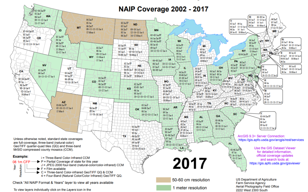
The FSA has released the planned coverage of their National Aerial Imagery Program (NAIP) for 2017. Last year, they began to collect some states at a 60-centimeter sample resolution versus the typical 1 meter and as it appears have decided to...
Running a precision software and mapping company, there are a few questions and comments that come around too frequently. Where do I start? What’s the cost? It will not work on my farm. Well to these questions, I have a standard response. “It depends!” The agronomist...