

ADMS - Drainage Consultants Package
LiDAR and NAIP access for drainage work, without the hunt for data.
The ADMS Drainage Consultants Package gives drainage consultants and tile contractors access to GK's LiDAR (where available) and NAIP imagery, so you spend your time making maps and save space on your computer.
What it does
Spend your time on the drainage plan.
Sourcing elevation data and imagery for every job eats hours and hard drive space. This package gives you access to both from GK's library.
LiDAR where it exists
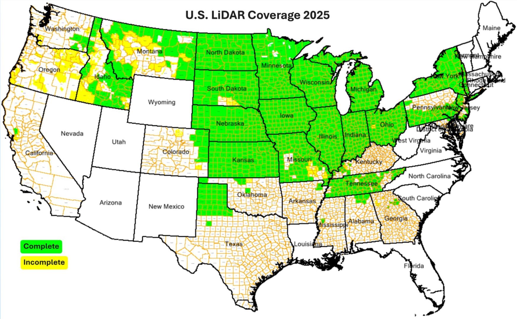
Import state and federal flown LiDAR topography data where it is available, and use it to drive the 3D features and the watershed modeling and drainage side of ADMS.
Years of NAIP imagery
GK's library holds NAIP (National Ag Imagery Program) images for most counties in the United States, so you can see how a field has looked across several years.
Room on your computer
Pull the data each job needs from GK's library instead of sourcing and storing it all yourself.
In ADMS
From data to drainage plan.
Real screens from GK's data server and ADMS. Pull the imagery and elevation, then put it to work on the drainage plan.
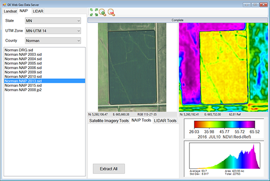
Aerial imagery by county
Browse the NAIP years available for a county and extract them for your fields.
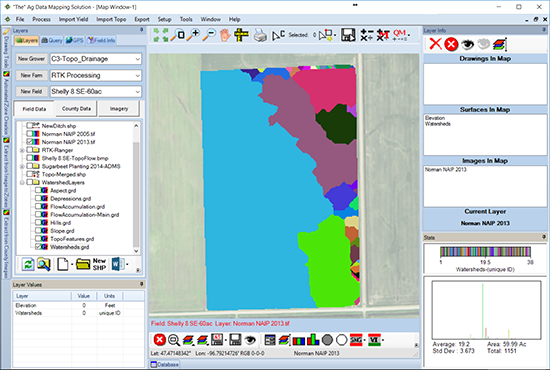
Where water collects
Elevation data drives watershed modeling in ADMS. Shown here with the Topography/Watershed module.
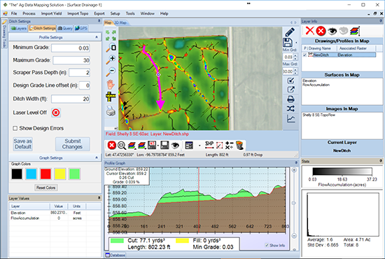
Plan the ditch or tile
Length, drop, cut, and grade on any path you draw. Shown here with the Topography/Watershed module's ditch tools.
Why GK?
35+ yrs
In precision ag
US & Canada
Where GK works
48 to 72 hours
Typical map turnaround
Exclusive Technology
Only offered by GK
How it works
From elevation data to drainage plan.
Outline the job
Create or import the field boundary in ADMS.
Pull LiDAR and NAIP
Access LiDAR where it is available, plus NAIP imagery, from GK's library.
Model the water
With the Topography/Watershed module, turn the elevation data into watersheds, flow, and depressions.
Plan the drainage
Lay out ditches and tile with side profile, grade, cut and fill, and depths worked out.
Pricing
The Drainage Consultants Package runs on the ADMS GPS Mapping base ($150 / year). It covers LiDAR (where available) and NAIP only, and does not include other ADMS packages, Sentinel or Landsat data, or free training classes.
Questions
Common questions.
Access to LiDAR data where it is available and NAIP imagery from GK's library. It is built to free up your time for making maps and to save space on your computer.
GK's 2025 LiDAR coverage map shows complete coverage across much of the Upper Midwest and Northern Plains, with partial or no coverage in other states. Ask GK about the counties you work in.
Sentinel and Landsat satellite data, free admission to training classes, and any other ADMS package. Purchase of this package does not include any other packages.
The package runs on the GPS Mapping (General) base. The watershed, flow, and ditch and tile planning tools are part of the Topography/Watershed module ($750 / year).
The Consultants Package ($2,600 / year) adds Sentinel and Landsat imagery, confidence mapping, faster processing tools, consultant mapping services, and free admission to all training classes.
Yes. GK's topography mapping and tile planning services handle the work for you. Send your fields and the team builds the maps and plans.
Contact
Get in touch with GK.
Tell us a little about your operation and what you are trying to solve. A real person in Halstad reads every message and follows up within a few hours.