

ADMS - Consultants Package
See exactly where water goes, before you dig
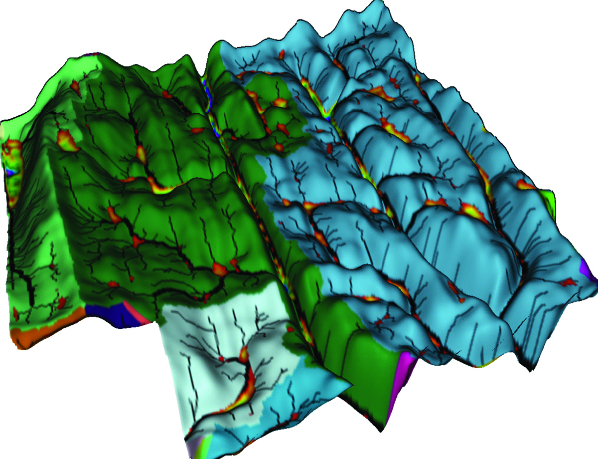
The ADMS Topography & Drainage module turns your RTK or LiDAR data into watershed models, wet-spot maps, and drainage plans, with the cut, fill, and slope already worked out, right on your own computer.
What it does
Stop guessing where the water goes.
Wet spots and washouts take acres out of production every year. This module shows you exactly how water moves, so you can plan around it.
Find every wet spot
The depressions layer marks where water stands, so you fix the acres costing you yield instead of hunting for them each spring.
See how water moves
Watersheds and flow accumulations show where water goes and how much reaches each outlet, so your drainage holds up.
Plan with real numbers
The profile tool gives you length, drop, cut, and slope on every path you draw, so you lay out ditches and tile with confidence.
From your data
The layers ADMS builds for you.
Import your topography points, drop any poor-quality data, and ADMS turns them into a full set of drainage layers.
Elevation & relief
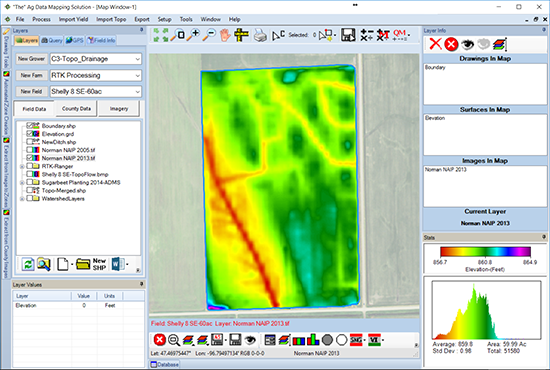
The rise and fall of the field, the base every other layer is built from.
Where water collects
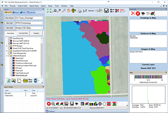
Every area of water flowing to a common outlet, each one its own color.
Where water runs
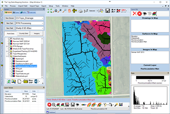
Where water wants to flow, and how much of it reaches each outlet.
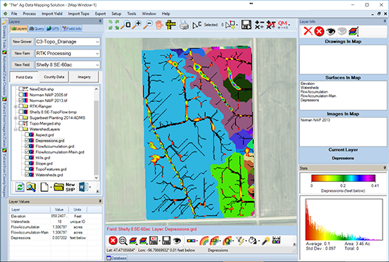
The wet spots
The low areas where water stands and drainage work is needed.
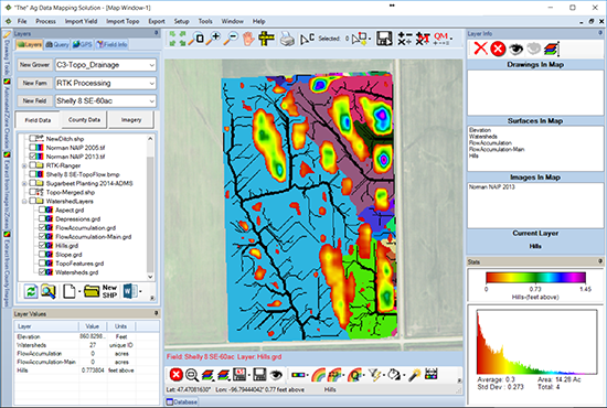
The high ground
The sloped, elevated areas that shed water quickly.
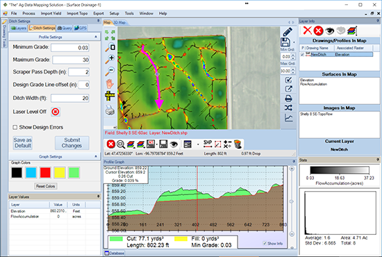
Plan the drainage
Length, drop, cut, and slope on any drainage path you draw across the field.
Why GK?
35+ yrs
In precision ag
US & Canada
Where GK works
48 to 72 hours
Typical map turnaround
Exclusive Technology
Only offered by GK
How it works
From field data to drainage plan.
Collect topography
Drive the field on 45 to 50 foot passes, and be sure to drive the ditch bottoms.
Import and clean
Bring your RTK or LiDAR points into ADMS and drop any poor-quality data.
ADMS builds the layers
Elevation, watersheds, flow, depressions, and hills, generated for you.
Plan your drainage
Use the profile tool to lay out ditches and tile with cut, fill, and slope.
Pricing
The Topography & Drainage module is an add-on to your ADMS GPS Mapping base ($150 / year). Buy it alongside Variable Rate and the second module is half price.
Questions
Common questions.
RTK or LiDAR topography points for your field. When you collect your own, drive 45 to 50 foot passes and be sure to drive the ditch bottoms so the low areas map correctly.
Yes. Topography & Drainage is an add-on module to the ADMS GPS Mapping base, which is the foundation every ADMS module runs on.
LiDAR is available in many areas. Where it is not, the module works from the RTK topography data you collect. Ask GK about availability for your fields.
Find the wet spots costing you yield, model how water moves across the field, and lay out ditches and tile with the length, drop, cut, and slope worked out for each path.
ADMS runs on Windows, versions 7 through 11. The mapping happens on your own machine, not in a browser.
Yes. If you would rather not run the software yourself, GK's mapping services handle topography and tile planning for you. Send your fields and the team builds the maps.
Contact
Get in touch with GK.
Tell us a little about your operation and what you are trying to solve. A real person in Halstad reads every message and follows up within a few hours.