

GK Mapping Services · Tile Planning
Tile drainage planning built on your field's own topography.
GK models how water flows across your field, works with you on the layout, and draws up tile plans in the best format for the equipment you use.
What you get
Know the plan before you trench.
Tile planning starts with a water flow model of your field, then turns it into a tile system that fits your needs.
Water flow models
GK models how water flows across the field, just as it does for surface drainage in the topography mapping service.
A layout that fits
Mains and laterals, outlets and lift stations, laid out with you and designed to your specifications.
Plans for your equipment
Drainage coefficient and tile depths worked out, with plans put in the best format GK can make for your equipment.
The deliverables
From flow model to tile plan.
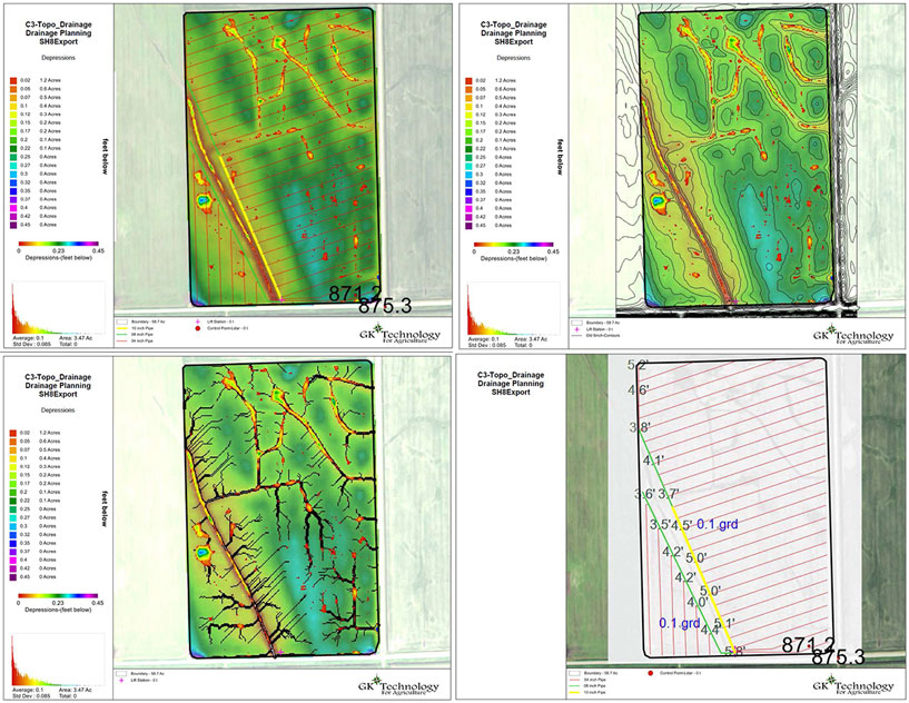
Real GK drainage planning output for one field, from the water flow model to the finished plan.
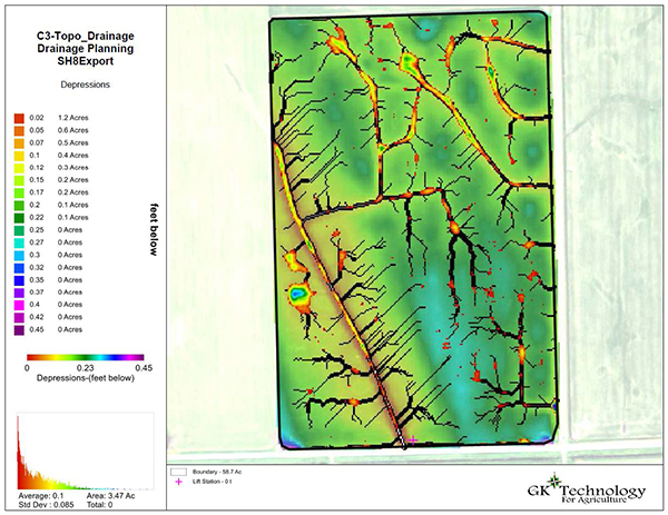
Where water wants to go
Flow paths over the depressions layer, with the lift station location marked at the outlet.
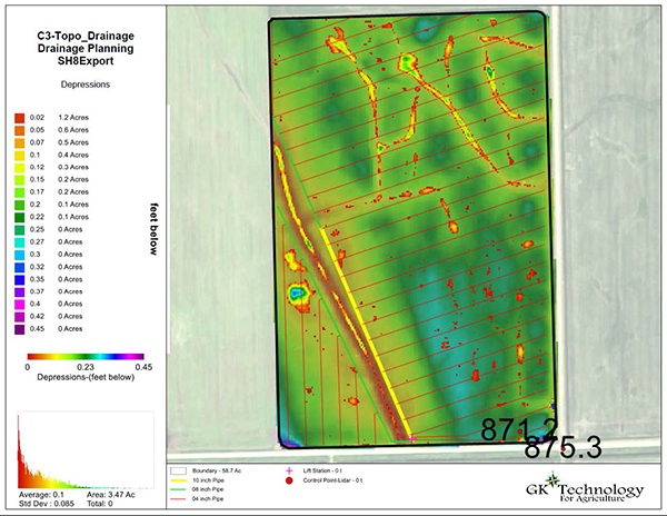
Mains and laterals
10, 8, and 4 inch pipe laid out across the field, with the lift station and a LiDAR control point.
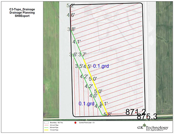
Depths and grade
Tile depths marked along the mains with the grade noted, ready for the equipment you use.
Why GK
GK pioneered RTK watershed modeling and in-cab drainage displays, with patented technology behind its SD Drain machine control.
How it works
From topography to tile plans.
Topography mapping
GK maps the field's topography first, from your RTK data or from LiDAR where it is available.
Flow modeling
GK creates the water flow model of your field.
Lay it out together
GK works with you on a tile system that fits your needs. Some in-field surveying may be required.
Get the tile plans
GK draws up the plans and puts them in the best format it can for your equipment.
Pricing
Tile Plans: mains and laterals, outlets and lift stations, drainage coefficient and tile depths, designed to your specifications.
- Watershed Modeling, the flow model built first$2.25/ac
Maps are turned around in 48 to 72 hours or on a planned timeline. A minimum field size applies. GK does not provide soil sampling, product application, or seeding, and does not give legal advice or fill out permits. All prices are subject to change.
Questions
Common questions.
The field's topography and your input. Grower input is required in this process, and some in-field surveying may be needed to finish the plans.
Yes. GK completes the topography mapping and flow modeling first, then works with you to lay out the tile system.
Mains and laterals, outlets and lift stations, and the drainage coefficient and tile depths, designed to your specifications.
GK puts the plans into the best format it can for the equipment you are using. Tell GK what you run when you request a quote.
Tile plans are billed at $220 per hour. Maps are turned around in 48 to 72 hours or on a planned timeline, and a minimum field size applies.
No. GK does not give legal advice or fill out permits, and does not provide soil sampling, product application, or seeding. GK can help you find equipment and service providers if you ask.
Contact
Get in touch with GK.
Tell us a little about your operation and what you are trying to solve. A real person in Halstad reads every message and follows up within a few hours.