

ADMS - Consultants Package
Satellite, NAIP, and LiDAR data for consultants
The ADMS Consultants Package opens GK's imagery library, with 30+ years of Landsat plus Sentinel, NAIP, and LiDAR, and adds confidence mapping, faster processing tools, and free admission to every classroom training.
What it does
More fields mapped, in less time.
Mapping consultants, dealers, and agronomists juggle a lot of fields every season. The Consultants Package puts the data, the tools, and backup from GK in one place.
Data on demand
Draw a boundary and click through GK's online library of Sentinel, Landsat, NAIP, and LiDAR. Extract as many fields as you want.
Zones you can stand behind
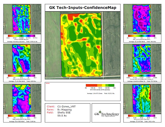
Confidence mapping merges multiple years of yield and imagery into Confidence, Maximum Productivity, and Average Productivity maps, showing how consistent each area really is.
Work faster
Multiple output scripts put all your Rx maps in one output, and quick math scripts build new maps from saved scripts in one click.
In ADMS
Pull the data, then trust the zones.
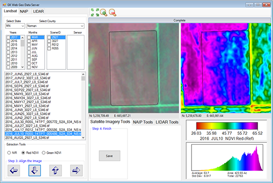
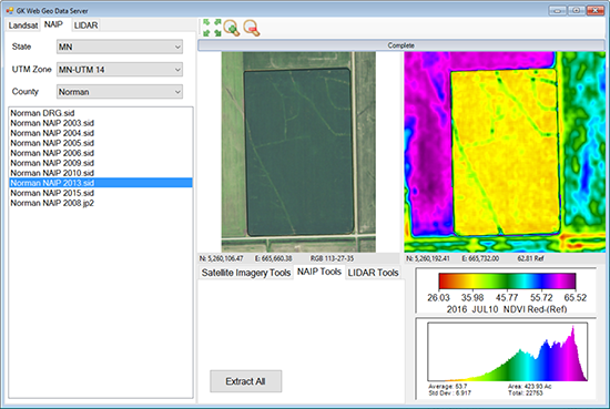
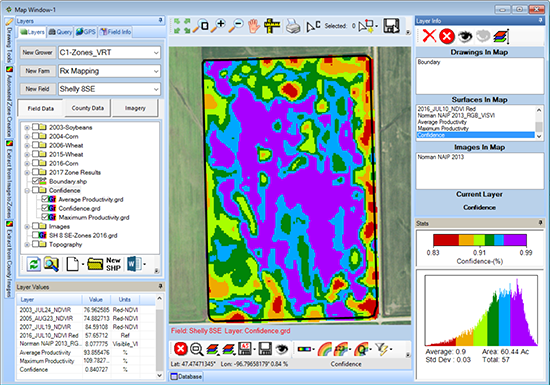
Real screens from GK's data server and ADMS. Extract imagery for a field, then merge it into confidence maps.
Decades of satellite imagery
Pick a state, county, year, and month, then extract Landsat scenes for a field as NIR, Red NDVI, or Green NDVI.
Aerial imagery by county
Browse the NAIP years available for a county and extract them for your fields.

Where Sentinel reaches
GK's 2025 Sentinel coverage map, with the current download areas outlined in red.
How stable each area is
Shows how consistent each area of the field is across every input layer, from erratic to stable.
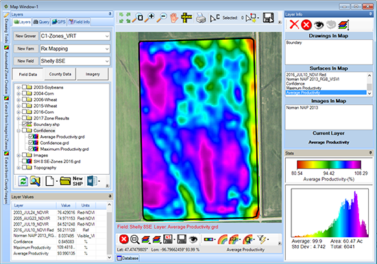
The field, normalized
All the input layers normalized into one map, most often used for management zones.
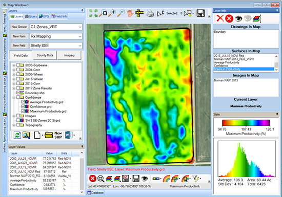
What the field can do
Highlights the production potential of each area, most often used for yield goals.
Why GK?
35+ yrs
In precision ag
US & Canada
Where GK works
48 to 72 hours
Typical map turnaround
Exclusive Technology
Only offered by GK
How it works
From boundary to finished maps.
Draw the boundary
Create the field boundary in ADMS, or import the one you already have.
Pull the data
Click through GK's library and extract Landsat, Sentinel, NAIP, and LiDAR (where available) for the field.
Run confidence mapping
Merge years of yield and imagery into Confidence, Maximum, and Average Productivity maps.
Deliver or hand off
Send all your Rx maps in one output, or hand the data to GK's consultant mapping team when you get busy.
Pricing
The Consultants Package runs on the ADMS GPS Mapping base ($150 / year) and does not include any other ADMS packages. Ask GK staff for consultant mapping service pricing.
Questions
Common questions.
Access to GK's online data, confidence mapping, faster processing tools, consultant mapping services, free admission to all classroom training, and an exclusive consultants meeting on recent precision ag topics and user requests.
Sentinel 10 meter and Landsat 30 meter satellite imagery, US FSA NAIP (National Ag Imagery Program) images for most counties in the United States, and state and federal flown LiDAR data where available. The Landsat library covers 30+ years.
It combines multiple years of yield, satellite imagery, aerial imagery, or any data that reflects production, and merges them into a Confidence Map, a Maximum Productivity Map, and an Average Productivity Map. Confidence Mapping is exclusive to GK.
No. Purchase of the Consultants Package does not include any other packages. Like every ADMS package, it needs the GPS Mapping (General) base enabled to run.
Consultant mapping services are part of the package. Hand the data off to GK and the team builds the maps. Contact GK staff for consultant mapping pricing.
Yes. The package includes free admission to all GK classroom training, plus an exclusive consultants meeting.
Contact
Get in touch with GK.
Tell us a little about your operation and what you are trying to solve. A real person in Halstad reads every message and follows up within a few hours.