

ADMS · Imagery/Yield/Variable Rate module
Variable rate prescriptions for seed and fertilizer, from your own data.
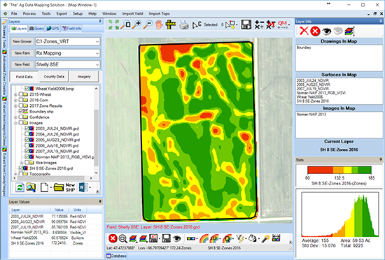
The ADMS Imagery/Yield/Variable Rate module turns imagery, yield, and Veris data into management zones and variable rate maps for fertilizer, lime, seed, and more, then exports them to common controllers.
What it does
Put the right rate on every acre.
Imagery and yield maps show where a field performs and where it struggles. This module turns that picture into zones and prescriptions you can run.
Use the data you have
Import JPG, TIF, BMP, and SID imagery, ECW, DAT, and LAZ data, yield files, and Veris maps. Crop large files to a field or county boundary to keep them small.
Build zones you trust
Merge imagery and yield data together, choose from several mathematical options, and adjust the zones to reflect what you know about the field.
Write the prescription
Create zone and grid maps for sampling, soil results maps, and variable rate maps for fertilizer, lime, seed, and chemicals, from 3 to 5 zones up to 200+.
In ADMS
From raw image to rate map.
Real screens from ADMS, following one field from a NAIP image to finished fertility and seeding maps.
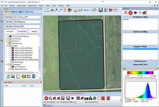
Line up the image
Adjust satellite and aerial images to a geo-referenced field boundary, so the map sits where the field really is.
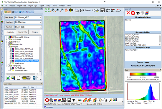
Turn the image into data
Extract an image with up to 255 colors. Shown here, a vegetation index surface from NAIP imagery.
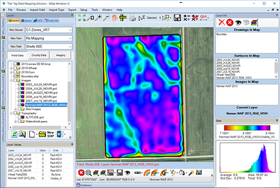
Smooth out the noise
Reduce the border effect on low resolution satellite images so the map shows what is happening in the field.
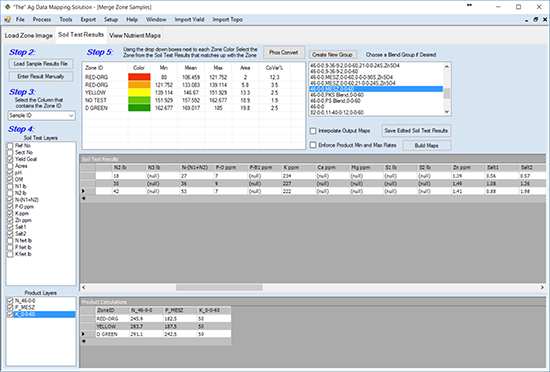
Tie results to zones
Match soil test results to each zone, then see the product amounts each zone calls for.
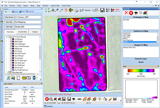
Interpolated rates
A 46-0-0 rate map built from zone results, with rates that change smoothly across the field.
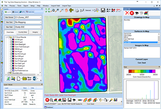
Variable rate seeding
A corn seeding rate map in seeds per acre, built on the same field's zones and ready to export.
Why GK
GK pioneered RTK watershed modeling and in-cab drainage displays, with patented technology behind its SD Drain machine control.
How it works
From imagery to prescription.
Bring in your data
Import imagery, yield, Veris, and soils data, and crop large files to your field boundary.
Clean and align
Geo-reference images to the field boundary, smooth them, and clean up yield data with quick tools.
Build the zones
Merge layers into management zones and adjust them to what you know about the field.
Write and export
Set rates from soil results and yield goals, then export variable rate maps to common controllers.
Pricing
Variable Rate Create is an add-on to your ADMS GPS Mapping base ($150 / year). Buy it alongside Topography/Watershed and the second module is half price.
Questions
Common questions.
It turns the data you already have, like imagery, yield, Veris, and soils maps, into management zones and application maps, so fertilizer, lime, seed, and chemicals go down at the right rate in each part of the field.
Most geo-referenced imagery, including JPG, TIF, BMP, SID, ECW, and GRD, plus data formats such as DAT and LAZ. ADMS can crop large files to a field or county boundary to cut the file size.
Variable rate maps export to common controllers. Tell GK which controller you run and the team will confirm the format before you buy.
Run 3 to 5 zone maps like you have in the past, or take it further with 200+ zones and fully interpolated rates.
Yes. Imagery/Yield/Variable Rate is an add-on module to the ADMS GPS Mapping base, which is the foundation every ADMS module runs on.
Yes. GK's imagery mapping service builds the zones and variable rate maps for you, most turned around in 48 to 72 hours. GK does not provide soil sampling, product application, or seeding.
Contact
Get in touch with GK.
Tell us a little about your operation and what you are trying to solve. A real person in Halstad reads every message and follows up within a few hours.