

Ag Data Mapping Solution
Too busy to map it yourself? GK will do it for you.
Send GK your field data and the team turns it into management zones, variable rate prescriptions, or drainage plans, delivered in your equipment's format and usually within 48 to 72 hours.
35+ years in precision ag | Runs across the US & Canada | In-Cab and Windows desktop
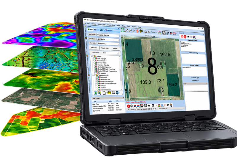
GK pioneered RTK watershed modeling and in-cab drainage displays, with patented technology behind its SD Drain machine control.
What we map for you
Four mapping services, done start to finish.
You provide the field, GK does the work, and you get finished maps you can use. Here are three, plus the one process only GK offers.
Stop guessing where the water goes.
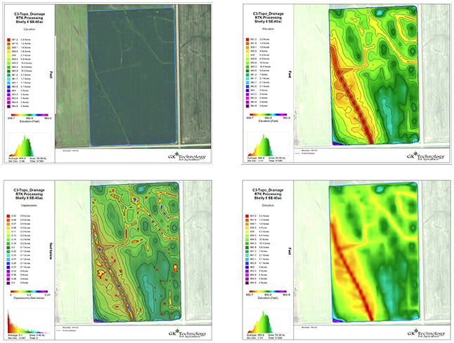
Wet spots and washouts take acres out of production every year. GK turns RTK or LiDAR data into a watershed model with accompanying map views, so you can see exactly how water moves and plan around it.
- Elevation, contours, and slope
- Flow paths, depressions, and hills
- Watershed areas for drainage planning
Put every input where it pays.
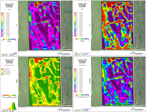
Flat-rate applications spend money on ground that does not need it. GK turns imagery and data layers into management zones and variable rate prescriptions, so seed, fertilizer, and lime go where they earn their keep.
- Zones from imagery, yield, and topography
- Variable rate maps for any input
- Written for your rate controller
Drain the ground that drowns every spring.
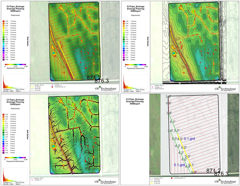
GK models how water moves across your field, then works with you to lay out a tile system and draws up the plans in your equipment's format, so the wet corners finally dry out.
- Water flow models of your field
- Tile layout built together with you
- Plans in your equipment's format
04 / Featured service
Exclusive to GKConfidence Mapping
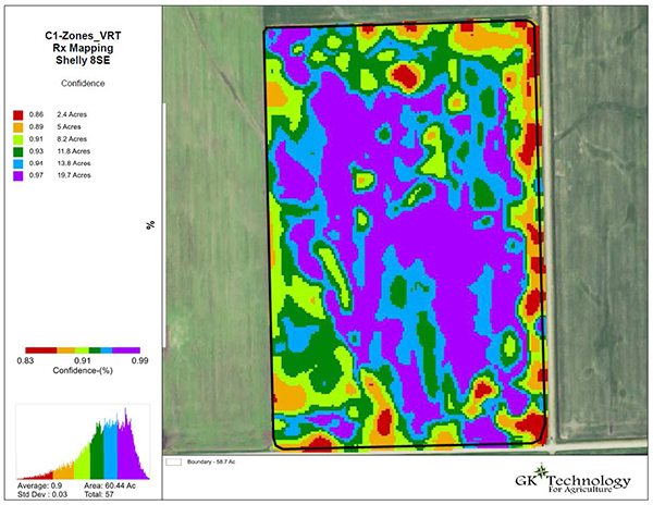
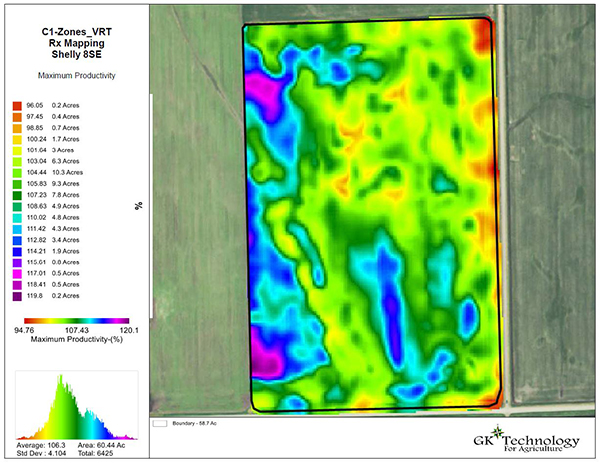
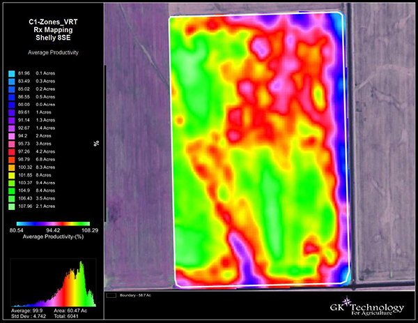
Confidence Mapping is GK's own zone-creation process, built in-house. It merges several years of yield and image maps into one, so your zones are built on what performs consistently, not on a single good year. It takes the guesswork out of zone creation: precision, with confidence.
How it works
Start to finish, GK handles the mapping.
Send us your fields
Share your field boundaries, any data you have, and your goals for the season.
We build your zones
GK creates your management zones and maps from your data.
You pull the samples
Sample the zones GK marks, then send the results back.
We deliver the maps
Your results become prescriptions and drainage plans, delivered to your applicator.
Grower input matters at every step, and some drainage projects need a little infield surveying to finish. GK does not provide soil sampling, product application, or seeding.
What it costs
Estimate your mapping.
Pick your services and your acres for a ballpark from GK's July 2026 rates. The exact scope and price come in your quote.
Also available, quoted by the job: Tile Plans, Land Shaping, Custom Mapping, and Customize Scripts at $220 per hour, and Updating Zones at $45 per field.
An estimate from GK's July 2026 rates. Final scope and price are confirmed in your quote. Prices subject to change. GK does not provide soil sampling, product application, or seeding.
Prefer another way?
Do it yourself, or work with someone local.
Run the same tools in-house with ADMS, or find a GK-trained mapping consultant near you.
Questions
Common questions.
Most mapping is delivered within 48 to 72 hours, or on a planned timeline for larger drainage projects. Ask when you send your fields and GK will give you a date.
No. GK builds the management zones for soil sampling, and you or your sampler pull the soil samples based off of the maps. GK does not provide soil sampling, product application, or seeding.
Whatever your equipment uses. GK builds application maps for many common controllers and can send data to a wide range of rate controllers. Ask about compatibility with your setup.
No. GK runs it and delivers the finished maps. If you decide to bring the mapping in-house later, ADMS is available and GK offers training.
LiDAR is available in certain areas. Where it is not, GK can process the RTK topography data you collect. Ask about availability for your fields.
Services are priced by the acre, and season packages bundle the year's mapping. Send your acres and GK will put together a quote for your job.
Contact
Get in touch with GK.
Tell us a little about your operation and what you are trying to solve. A real person in Halstad reads every message and follows up within a few hours.